St Michael and St Mary lines
by 5ocietyx

According to Jiro Olcott if you were given a ruler and a map (or better still Google Earth) and asked to draw the longest line in Britain without crossing water you will end up with a track that stretches from the tip of Lands End to the Norfolk coast near the town of Hopton.
This old straight track is known as the St Michael and St Mary line.
Olcott goes on to say
Coincidentally this also happens to be the exact axis along which the May Day sun rises over Britain.
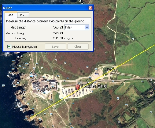
This is not the only astronomical coincidence. The distance from coast to coast between these two end-points of Lands End and Hopton measures 365.24 miles precisely.
1 solar year = 365.242199 days
Stone circles, abbeys, tors, mounts, churches, man-made mounds, castles, holy wells and henges have been situated all along these currents. Academia would dismiss this holographic cryptogram as a mere sequence of happy coincidences or simply irrelevant.
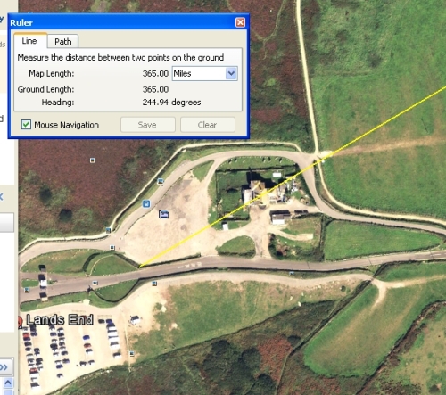
It is 365.00 miles precisely to the circular grass entrance to Lands End that is marked with stones.

If the creative force of the universe is able to create the universe perhaps it can intelligently design the dimensions of an island, the undulations of the land or the flow of a river any way it so pleases.


[…] Michael’s Mount lies on the St Michael line previously discussed here. Share this:TwitterFacebookDiggStumbleUponEmailLike this:LikeBe the first to like this. […]
[…] St Michael and St Mary line The Giant of St Michael’s Mound The Mystery of Mont Saint Michel and Saint Michael’s Mount […]
My blog concerns UK alignments of ancient sites, often following them by satellite. I have done a post following the ST. Michael/Mary line but all posts refer to it. Perhapeit will be of interest; …. https://ancientwhisperspenwith.blogspot.com/